highlike

Masaki Fujihata

Voices of Aliveness
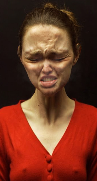
This project, upon the initiative of l’Ecole des Beaux-Arts de Nantes, has been conceived as a meta-monument where are gathered video sequences recorded by a camera with GPS. People are screaming while biking in a 500 m circle in the countryside. The traces of this route can be visualized thanks to lines that form a sort of tower in the virtual space, where it can go on indefinitely. On these lines, in an order that looks more like a music score than a succession of shootings, mobile video screens simultaneously display the image of the performances.

Parse/Error

ISS Tracker
El ISS Tracker sigue a la Estación Espacial Internacional en tiempo real mientras viaja alrededor del mundo, rastreando su órbita y apuntando a su posición en el cielo en todo momento. Un proyecto inspirado en mi fascinación por el espacio, que siempre ha estimulado la imaginación de la humanidad. Un tributo a la destreza técnica de la ISS y a los astronautas a bordo. La Estación Espacial Internacional tarda aproximadamente 92 minutos en dar la vuelta a la Tierra. El ISS Tracker utiliza parámetros orbitales de dos líneas, o TLE (para elementos de dos líneas), para determinar la órbita de la estación y calcular su posición. El azimut y la elevación se calculan contra las coordenadas GPS del observador, la fecha y la hora, para definir la dirección al punto. La posición de la ISS se vuelve a calcular cada 10 segundos y se actualiza la dirección señalada por la mano del ISS Tracker.

Parse/Error

ISS Tracker
L’ISS Tracker suit en temps réel la Station Spatiale Internationale dans sa course autour du monde, en suivant son orbite et en pointant du doigt sa position dans le ciel à tout instant. Un projet inspiré par ma fascination pour l’espace, qui a toujours stimulé l’imagination de l’espèce humaine. Un hommage à la prouesse technique que représente l’ISS, et aux astronautes à son bord. Il faut environ 92 minutes à la Station Spatiale Internationale pour faire le tour de la Terre. L’ISS Tracker se base sur les paramètres orbitaux à deux lignes, ou TLE (pour Two-Line Elements), pour déterminer l’orbite de la station et calculer sa position. L’azimut et l’élévation sont ensuite calculés par rapport aux coordonnées GPS de l’observateur, la date et l’heure, afin de définir la direction à pointer. La position de l’ISS est recalculée toutes les 10 secondes et la direction pointée par la main de l’ISS Tracker est mise à jour.

David Bowen

The other side
This installation automatically creates a three-dimensional relief carving of the current cloud formations and ocean surface conditions on the opposite side of the earth from the location of the gallery space. Using satellite data from the Nasa Earth Observing Information System and the GPS coordinates of the gallery, the installation obtains a current image of an approximately six hundred square mile area on the opposite side of the earth from its location. Using custom software, the system converts this image into a relief model that is sent to an onsite CNC machine hanging upside down in the gallery space. The CNC machine carves the relief in pink foam with its upside-down orientation directly echoing the cloud and ocean topography on the opposite side of earth.

Raphaela Vogel

Isolator
“A further characteristic of Vogel’s practice is the way she uses the camera: she dispenses with a crew completely, she is always both protagonist and cameraperson. Vogel guides the camera using drones and thereby controls what we see and is not just an object. The camera itself becomes thus a protagonist of sorts, a counterpart or, as in the aforementioned scene, a playmate and a stalker: Vogel wears a controller to which the drone – an “airdog” equipped with a GPS tracker – responds and automatically follows her”. Kristina Scepanski

Richard Vijgen

The Architecture of Radio
In case you’ve ever wondered exactly what lies beyond the realm of the visible, Dutch designer Richard Vijgen has created a new app that is able to visually portray the network of radio waves that lies below the surface. The app was created as a part of Vijgen’s new ”The Architecture of Radio” exhibition at Germany’s ZKM, and combines technologies from GPS, OpenCellID, and NASA’s public satellite feeds to amalgamate a rendering of the data webs all around us. The app was intended to give a physical portrait of the very data waves that rule the modern day, according to Vijgen: “We cannot see the very thing that is defining our time, and that concerns me.” The designer went on to note “as technology is becoming more and more transparent, I think data visualization can help us to relate to things that are invisible, yet play an important role in our lives.”

ANDRZEJ DRAGAN

安杰伊·德拉甘
АНДЖЕЙ ДРАГАН
アンジェイ·ドラガン
Time dilation

Andrzej Dragan ist ein polnischer Fotograf mit einem hochgelobten Doktortitel in Quantenphysik. Wenn er seine beiden Leidenschaften vermischt, gibt er uns einen Physikkurs über Zeitdilatation. Die relativistische Gravitationstheorie besagt, dass die Krümmung der Raumzeit (aufgrund der Gravitation) die Zeit im Vergleich zu der außerhalb des Gravitationsfeldes gemessenen verlangsamt. Eine Uhr im Erdmittelpunkt bleibt hinter einer Uhr an der Erdoberfläche zurück. Am Ende des Videos werden die Auswirkungen der Schwerkraft auf das GPS erläutert. Zwischen der von den Satellitenuhren angezeigten Zeit und der des GPS auf der Erdoberfläche liegt ein Fortschritt von 38,7 µs pro Tag. Dieser Unterschied führt zu einem potenziellen Fehler von 11 km bei der Geolokalisierung. GPS-Berechnungen integrieren diesen Unterschied, um eine Position mit einer Genauigkeit von wenigen Metern zu bestimmen.

SHO HASHIMOTO AND TAKASHI MATSUMOTO

pileus: internet umbrella
Pileus is an umbrella connected to the Internet to make walking in rainy days fun. Pileus has a large screen on the top surface, a built-in camera, a motion sensor, GPS, and a digital compass. The current prototype has two main functions: photo-sharing and 3D map navigation.The photo function is connected to a major web service: Flickr API. A user can take photo with a camera on the umbrella, and pictures are uploaded to Flickr in two minutes with context tags via a wireless Internet connection. User can also enjoy theirselves watching photo-streams downloaded from Flickr with simple operation of wrist snapping.

DOMINIC WILCOX

دومينيك ويلكوكس
多米尼克·威尔科克斯
דומיניק וילקוקס
ドミニク·ウィルコックス
Доминик Уилкокс
GPS shoes